
Download PDF Responses to comments made about Joe Rogan Podcast
An open letter to a critic on the matter of chevrons, megatsunamis and bolide impacts.
Recently I did a podcast with Joe Rogan. In our wide ranging discussion we covered a lot of material. As pleased as I was by the positive response of many in the listeners, I also appreciate and welcome criticism and open minded debate. I do not pretend to have the final truth on anything, I only know that it is fair to question everything and to go where the evidence leads us, in the assumption that science, ultimately, is a search for truth. I am convinced that even in the world of science dogmas and entrenched viewpoints can at times prevail over facts and evidence inconsistent with established beliefs. It is important to constantly be challenging dominant paradigms to keep science moving forward and to approach ever closer to an understanding of reality. I repeat, I do not claim to have the final word on any of the issues discussed on this or any other podcast in which I have participated. I engage in the pursuit of science for the love of learning and out of an irrepressible curiosity about the world we inhabit. No one, at least up to this point, has paid me to engage in this pursuit. I fund my own way and have done so for going on four decades. In reading through the many posted comments in response to the podcast it became apparent that the majority of comments critical of something I said are conspicuous for the absence of any actual learning or knowledge about the subject being commented upon. Quite a few of the negative comments were simply trash talking by fools who couldn’t make a coherent counterfactual argument if their life depended on it. A few of the critical comments contradict this trend and actually represent some learning or at least some rational thought regarding many of the issues I raised during a three hour wide ranging discussion, and for these I am appreciative.
I am addressing this response to one issue raised regarding remarks about possible mega-tsunami deposits that I brought up during the podcast. It is my impression after investing a fair amount of time researching this phenomenon that it warrants serious consideration, especially in light of what we have witnessed during the past decade, two tsunami induced mega-disasters in Japan and the Indian Ocean. Several comments were particularly dismissive, so I am setting down this small exposition, without malice, to demonstrate that the remarks made on The Joe Rogan Experience were preceded by a substantial amount of background research and thought. While the following remarks pertain to this one issue specifically, they are also relevant to the general attitude evinced in many of the other comments critical of something I said that are obviously being made by individuals whose preconceived opinions were incompatible with the information I presented and their objections were nothing more than a knee jerk emotional response rather than a reasoned critique with some actual thought behind it.
Here is a comment posted by someone who took issue with my remarks about the possible mega-tsunami deposits in Madagascar. I choose this posting to respond to for two reasons. First of all it allows me the opportunity to elaborate in more detail regarding this important question of the reality of mega-tsunamis, not only to our past but to our future, and the posting also displays one of the most common of logical fallacies in critical thinking, the “appeal to authority.” Disregarding the obvious attitude of cynicism, this is what Mary Kay Dunn had to say:

First of all let’s dispose of the appeal to authority canard. I have no doubt that Joanne Bourgeois, whose work is the subject of the linked article, is a “real scientist.” In fact, I have a great deal of admiration for her work and have read a number of her papers, including her 2009 paper in Geology taking issue with the mega-tsunami hypothesis of Dallas Abbot and others. The statement is made by the Ms. Dunn that “real scientists” have discredited the mega-tsunami hypothesis. My first thought is this: How easy it has become these days to simply link to a website presenting one side of a scientific debate and then presumptuously assume that the matter is settled. Then follows an egregiously over generalized statement about Joe Rogan “fans.” Certainly it is true that some of the world’s scientists are bought off by one of two political sides, a blatant case in point being many of the scientists employed by the IPCC. However, it should be emphasized that there are many scientists who retain their independence and credibility, and it is probably true that some Joe Rogan fans believe in conspiracies of one sort or another but it has become apparent to me that many of them are willing to look without prejudice at the facts, and I would say this goes for Joe himself. Let it also be stated that as far as conspiracies go, there are definitely real ones. History itself is basically a history of conspiracies. Anyone who thinks that those who covet power do not conspire to retain and expand that power, or that they would not subordinate science to that end, is suffering from excessive naivety, however, all this is a total non sequitur anyway in reference to the subject at hand.
So, as to the question of “real scientists” here are just a few of the professionals who first proposed and have continued to endorse the idea of mega-tsunami generated chevrons:
Dieter Kelletat, Ph.D: Retired as head of the Dept. of Physical Geography, University of Cologne, expert in Quaternary Geomorphology, author of the Atlas of coastal geomorphology and zonality and numerous scientific publications and collaborations.
Dallas Abbott, Ph.D: Research scientist at Lamont-Doherty Earth Observatory of Columbia University, Ph.D. in Marine Geology, author or co-author of over 120 peer-reviewed scientific papers. Author of Chevron Dunes in Madagascar: The Most Spectacular Tsunami Deposits on Earth published in the proceedings of the Aerospace Conference, 2000 IEEE
Dee Breger: Manager of Lamont Doherty Scanning Electron Microscope Facility, participant in more than 30 land based and oceanographic expeditions. Expert in analysis of microscale evidence of cosmic impact.
Viacheslav Gusiakov Ph.D, : Head of the Tsunami Laboratory, Institute of Computational Mathematics and Mathematical Geophysics, Novosibirsk, Russia, responsible for developing the Historical Tsunami Database for the World Ocean
Anja Scheffers Ph.D,: Southern Cross University, Associate Professor of Geoscience, expert in coastal evolution, sea-level change and marine natural hazards. See Curriculum Vitae here: tsun.sscc.ru/hiwg/SCHEFFERS.htm. Author or co-author of at least 42 peer reviewed scientific papers. Is considered by her colleagues to be a chevron expert.
There are more but I think you get the point.
If these people aren’t “real scientists” then nobody is, certainly they are as “real” as Dr. Bourgeois. But in the end what matters are not the credentials of an individual but the facts. The history of science is littered with examples of highly credentialed scientists who ended up being spectacularly wrong about one thing or another when more information became available. It is also replete with examples of outsiders who took on the academic establishment and prevailed against entrenched dogmas.
Here is the reference for the article linked by the poster:
The article, posted also on the University of Washington website, was based upon work by Bourgeois and her colleague Robert Weiss that was about to be published in the journal Geology, the next month. (“Chevrons” are not mega-tsunami deposits—A sedimentologic assessment: Geology, Vol. 37, no. 5, May, 2009, pp. 403 – 406) The website article begins by describing the formations in question as “large dunes shaped something like the stripes you might see on a soldier’s uniform that are hundreds of meters to a kilometer in size and were originally found in Egypt and the Bahamas.” It goes on to say that “the discovery of similar forms in Australia and Madagascar led some scientists to theorize that they were, in fact, deposits left by huge tsunami waves, perhaps 10 times larger than the devastating Indian Ocean tsunami of December 2005.”
It goes on to say that “the discovery of similar forms in Australia and Madagascar led some scientists to theorize that they were, in fact, deposits left by huge tsunami waves, perhaps 10 times larger than the devastating Indian Ocean tsunami of December 2005.”
The article goes on to say that geologist and tsunami expert Jody Bourgeois considers that idea to be “nonsense.” Of course the word “nonsense” is not in quotes and is therefore attributable not to Bourgeois but to the author of the article. Quotes directly attributable to Bourgeois are bit more measured. A popular treatment of her opinions also appeared in the online version of Earth for Wednesday, August 5, 2009. Bourgeouis makes the argument that the chevrons on Madagascar are not the product of tsunamis but of wind. She bases this conclusion upon 3 primary considerations.
Her first objection to the giant tsunami hypothesis is that forms similar to them are found in continental interiors. As an example she correctly points out that “They are the same forms in the Palouse in eastern Washington State, and those are clearly not from a tsunami.”
The comparison with the Palouse in eastern Washington I find to be very suggestive. The Palouse is one of the most spectacular loess deposits found around the planet. The exact mechanism of loess deposition is still being debated but an aeolian (wind) process is usually considered the most likely. Also there is no doubt that when the Palouse loess was devoid of stabilizing biomass it would be subject to modification by wind. In her 2009 Geology article, Bourgeois argued that since forms such as the Palouse landscape, very similar to the coastal chevrons in Madagascar, are found within continents this proves that the coastal chevrons are not created by tsunamis. However, a growing mass of evidence supports the idea that large scale megafloods have occurred over vast areas, affecting many of the major river valleys and ancient lake basins of continental interiors, and have left distinctive geomorphic evidence of their passage, including chevron-like formations.
However, a growing mass of evidence supports the idea that large scale megafloods have occurred over vast areas, affecting many of the major river valleys and ancient lake basins of continental interiors, and have left distinctive geomorphic evidence of their passage, including chevron-like formations.
Bourgeois comments on the presence in the chevron of marine fossils found by the Abbott team in a Science Daily article:
“Marine fossils can get into non-marine deposits. It’s not uncommon. You only have to change sea level a little bit or have them wash up on a beach in a storm . . . And some marine organisms can be carried by the wind. I am convinced these are largely wind-blown deposits.”
Here Bourgeois is extremely vague about the process whereby marine fossils get into non-marine deposits. Note the qualifying term: “I am convinced that these are largely wind-blown deposits.” Largely, but not totally? A potential problem with this assumption is that actual samples taken from the chevron deposits by Abbott and her team were reported to contain benthic foraminifera, which are ocean bottom dwelling organisms. The type of species can be used as a depth indicator. These were deep sea dwellers. How does changing sea level “a little bit” extract these forams from the deep ocean floor and deposit them many km inland? I think description of the specifics of this process would be obligatory to claim that Bourgeois’ work could be considered to have debunked the mega-tsunami hypothesis.
How does changing sea level “a little bit” extract these forams from the deep ocean floor and deposit them many km inland? I think description of the specifics of this process would be obligatory to claim that Bourgeois’ work could be considered to have debunked the mega-tsunami hypothesis.
Having read and reread Bourgeois’ 2009 Geology article I find no reference to the discovery by Dee Breger of cosmic material fused to the marine fossils found within samples extracted from the chevrons by the Abbott team. When Breger examined the samples under a scanning electron microscope she found that many of the fossils had significant amounts of nickel, chrome and iron welded to the fossils. Where did this come from? Is it just a coincidence that they were found in the same relative proportions as would result from the vaporization of a chondritic meteor impacting into the ocean?
Abbott and her colleagues dispute the assumption that the chevrons were formed by wind as claimed by Bourgeois. In a paper presented at the 2006 Philadelphia Annual Meeting of the Geological Society of America titled Impact Craters as Sources of Megatsunami Generated Chevron Dunes they state:
“Chevron dunes are not formed by wind. Chevron dunes are not oriented in the direction of the prevailing wind, they can form where there are no beaches, and they contain grains larger than 2 mm in diameter. Chevrons are produced by megatsunamis originating from point sources, i.e. landslides, impact craters, and volcanic explosions. We have assembled data on chevrons worldwide. Most are best explained as the result of tsunami generated from large impact cratering events.”
The matter of grain size is important as discussed below. After 4 more years of research and study the same authors wrote:
“Although some propose a wind-blown origin for V-shaped chevron dunes that are widely distributed around the coastlines of the Indian Ocean and in the Gulf of Carpentaria, we have evidence in favor of their mega-tsunami formation. In southern Madagascar we have documented evidence for tsunami wave run-up reaching 205 m above sea-level and penetrating up to 45 km inland along the strike of the chevron axis. Subtly, the orientation of the dunes is not aligned to the prevailing wind direction, but to the path of refracted mega-tsunami originating from Burckle impact crater.”
“The results of our study show that substantive oceanic comet impacts not only have occurred more recently than modeled by astrophysicists, but also that they have profoundly affected Earth’s natural systems, climate and human societies.”
(Viacheslav Gusiakov, Dallas H. Abbott, Edward A. Bryant, W. Bruce Masse, Dee Breger (2010) Mega Tsunami of the World Oceans: Chevron Dune Formation, Micro-Ejecta, and Rapid Climate Change as the Evidence of Recent Oceanic Bolide Impacts. Geophysical Hazards, International Year of Planet Earth, pp. 197 – 227)
It is not the least bit surprising that some researchers would find the proposition of tsunami waves hundreds of feet high in the recent geological history of the Earth disconcerting, and this is the way it should be, extraordinary claims do require extraordinary proofs, and it is up to Abbot et al. to make a strong case for their claim before it is accepted by the scientific community. However, there is nothing intrinsically unsound or implausible about the basic idea of a cosmic impact into the ocean. It has undoubtedly occurred multiple times throughout the history of the planet, and there is no doubt whatsoever that an impact of a sizable object, say a mile or two in diameter, into the ocean would generate tsunamis of prodigious size.
Using empirical formulas scaled from underwater nuclear testing Jack Hills and Charles Mader of Los Alamos National Laboratory were able to determine that a stony asteroid with a 600 meter radius could generate a wave with amplitude near dozens of meters high as it made landfall, up to 1000 miles from the epicenter, and could penetrate inland, depending upon topography, up to 100 miles. Whether formed by wind or water, the Madagascar chevrons, supposedly discredited by Bourgeois, are oriented along an axis with a back azimuth of about 120 degrees, pointing in the direction of origin. When the Abbott team projected this line about 900 miles to the southeast they found a large crater-like feature on the floor of the Indian Ocean. Deep sea core samples taken in the vicinity of this feature contained magnetic spherules, some nearly pure carbon, tear-drop shaped tektites and unique vitreous material.
The fact that a crater-like formation on the floor of the Indian Ocean, in the appropriate location, has been identified and associated with cosmic material is powerful evidence supporting the possibility of a very large impact induced tsunami. However, further in situ investigation is required to prove one way or another whether this large, circular feature is in fact produced by the impact of a cosmic object, a prospect rendered difficult by virtue of the fact that it lies under two miles of ocean water.
Michael E. Brookfield, PhD. with the University of Massachusetts, Department of Environmental, Earth and Ocean Sciences presented a paper at the first joint meeting of IGCP 490 and ICSU “Rapid and catastrophic environmental changes in the Holocene and human response”, entitled Deposits of tsunamis and their recognition. The remarks he made include the following:
“Tsunami waves are produced by any process, which vertically displaces the sea surface. Such processes, accompanied by earthquakes, include direct displacement by extraterrestrial impacts, and displacements of the sea floor caused by explosive submarine eruptions, fault movements, and submarine slides . . . Tsunamis capable of affecting deep shelf and oceanic sea floors . . . need to be of very large amplitude and wavelength . . . Most open ocean tsunami waves have the required wavelengths but not the amplitude (a few metres maximum) to significantly move sediment in deep water. Tsunamis of the order of metres in amplitude are relatively common in all oceans, and at least 50 large tsunami deposits (>5 metre runup height) occur on the Pacific coast of Kamchatka over the last 7,000 years. More than 2,000 tsunami events have been recorded during the past 4,000 years, some with run-up heights of over 100 metres . . . Large meteorite impacts into oceans can immediately displace the entire water column and generate tsunamis initially higher than the depth of the ocean. A large kilometre-sized asteroid impacting a deep ocean generates initial tsunami waves of comparable height to the ocean depths, and these would still be more than 100 metres high when they reached the surrounding coasts . . . Tsunami deposits can be recognized primarily as rapidly deposited, tabular and extensive unusually coarse layers laid down (or at least) reworked by traction currents within finer grained sections.”
A significant fact brought out by Brookfield’s remarks above is that most open ocean waves are of low amplitude and hence incapable of entraining deep ocean bottom sediment, including benthic forams such as found in the Madagascar chevrons. As he points out “Tsunamis capable of affecting deep shelf and oceanic sea floors, however, need to be of very large amplitude and wavelength . . .” and that “Large meteorite impacts into oceans can immediately displace the entire water column . . .” Again, to assume that the Madagascar chevrons are purely the product of wind neglects the specifics of the process whereby deep sea marine fossils are incorporated into the chevron sediments, not to even mention the process by which they come to be fused with nickel, chrome and iron in relative cosmic proportions.
It is not unlikely that the depositional signature of a tsunami generated by an asteroid impact would be distinct from that generated by an undersea seismic event, especially if the incoming object was in some stage of fragmentation when it encountered the ocean.
This could modify the refraction pattern of the wave trains considerably, adding a level of complexity not found in a wave train emanating radially from a seismic epicenter. As discussed in the last sentence of Brookfield above tsunami deposits are described as being composed of “extensive unusually coarse layers laid down by traction currents.” A traction current is one in which the water is moving material of a varied size and coarseness that can range from sand and silt up to large boulders. Further investigation of the stratigraphy and sedimentology of the chevrons is necessary before anyone can come to a final conclusion about their origin.
Further investigation of the stratigraphy and sedimentology of the chevrons is necessary before anyone can come to a final conclusion about their origin.
“Landward-pointing V-shaped sand ridges several kilometers long are common along the windward margin of the Bahama Islands. Their axes share a northeast-southwest trend. Internally, the ridges contain low-angle oolitic beds with few erosional truncations. Commonly interbedded are tabular, fenstrae-rich beds such as those formed by sheet flow of water over dry sand. Defined here as ‘chevron ridges,’ these landforms appear to have originated in the rapid remobilization of bank margin ooid bodies by the action of long-period waves from a northeasterly source. Deposits along adjacent coastlines also preserve evidence of the impact of large waves.”
Later in the article they address the question of aeolian (wind) formation.
“Although similar to parabolic dunes in gross morphology, several features in chevrons demonstrate that chevrons are deposited by water rather than by wind. These distinctions include the presence of beach fenestrae, (perforations) graded bedding, and the absence of the compact bedding and bedforms typical of the migratory parabolic dunes. Indeed, there are no known examples of true migratory carbonate dunes in the Bahamas despite abundant sand supply and strong prevailing winds. As described below, runup deposits and giant boulders provide supporting evidence of the occurrence of large waves during the last interglaciation on pre-existing, older coastlines adjacent to the lowland areas where chevron ridges are found.”
So here are reputable scientists, who presumably have no stake in the outcome of the megatsunami hypothesis, asserting that chevron formations in the Bahamas, while smaller in scale than those in Madagascar, are, nonetheless, produced not by wind but by water in the form of large waves, and they offer some rather convincing evidence.
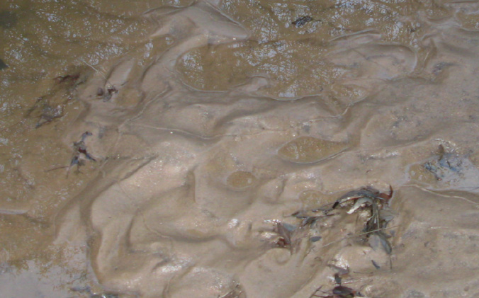
Let’s address one more issue. In the first quote by Abbot et al. I have underlined an important point. Regarding the sediment composing the chevrons they state that “they contain grains larger than 2 mm in diameter.” In fact, the team identified 10 cm (4 inch) thick lag deposits of shells in some chevrons which is inconsistent with aeolian deposition. Remember, they actually visited Madagascar and extracted samples.
In the computer model employed by Bourgeois and Weiss they test sediment transport regimes by calculating for flow velocity using a formula developed previously by R. I. Ferguson and M. Church for the “fall velocity” of different sized sediments in a variety of current flow situations. (A Simple Equation for Grain Settling Velocity, Journal of Sedimentary Research, v. 74, #6, Nov., 2004). In regards to fall velocity civil engineer John P. Ahrens says “Increased interest in fall velocity reflects acknowledgement of the fundamental physical importance of this variable in littoral sedimentation processes. Fall velocity has a strong influence on suspended sediment transport, beach profile shape and evolution, and beach morphology.” (Ahrens, John P., March, April, 2000: A Fall-velocity Equation; Journal of Waterway, Port, Coastal and Ocean Engineering; Vol. 126, No.2, pp. 99 – 102)
The point of this is that the chevrons take the form of ripples and dunes, and Bourgeois and Weiss assume that this form implies more subdued water flow in which the sediment is primarily transported as bed load rather than as suspended sediment, and that a more powerful flow, such as a tsunami, would deposit a continuous sheet of sand. However, some of the large chevrons overlap onto the coast up to 2 or more miles. As a sea wave traverses over land it undergoes substantial attenuation and energy loss. At the distal reach of sediment deposition the wave has essentially lost all of its forward momentum and begins its backwash into the ocean. It only makes sense that there would be a continuum of energy loss and transformation from suspended load to bedload along the depositional pathway.
The morphological effects of fall velocity on beach evolution is dependent upon grain size, symbolized by the letter D in the fluid mechanics formulas employed in the computer models. (D = grain diameter). In the formula used in for their calculations the value of D for Madagascar chevrons is given as .0002 meters, or 2 millimeters, which is typical of wind deposition. (See Table 1 in Bourgeois and Weiss, 2009) However, as quoted earlier Abbott and her team unambiguously state that the chevrons “contain grains larger than 2 mm in diameter.” Clearly, additional research is needed to settle this disagreement. Sedimentary grains in the chevrons substantially larger than 2 mm would invalidate the computer models.
An important point made by the Abbott team was articulated in the journal Zeitschrift für Geomorphology in 2008. From the abstract:
“Chevrons are enigmatic yet understudied sedimentary structures. This paper presents a comprehensive description of chevrons along the world’s coastlines . . . Although morphologically variable, chevrons all show lancet-like forms at different shoreline angles. Their origin could only be wind or waves driven. Although many chevrons resemble narrow parabolic coastal dunes, a young aeolian genesis can be excluded where orientation contradicts main wind direction, or where no beach sand or sand deposit exists. Where storm origin can be excluded due to chevron height and extension far beyond storm wave reach pre-historic tsunamis were considered.”
Summarizing key points and questions regarding this controversy:
If wind blown what was the source of the sediment composing the chevrons where there is no substantial beach sand available?
How were deep sea microfossils originally entrained in the sediments?
What is the explanation for the presence of nickel, chrome and iron fused to the fossils
as found by Dee Breger?
The chevron formations of Madagascar match other smaller scale chevron formations attributed to large waves or to flowing water by other well qualified researchers. Parabolic forms in the Madagascar chevrons mimic those of the Palouse landscapes of Eastern Washington which were likely the product of subaqueous alteration. Many of the chevrons studied by geologists have large boulders associated with them, sometimes, weighing hundreds of tons. These boulders were not emplaced by wind.
Many of the chevrons studied by geologists have large boulders associated with them, sometimes, weighing hundreds of tons. These boulders were not emplaced by wind.
Clearly, more work is needed. I have addressed this issue somewhat in depth as the comments by my online critic are all too typical. The crucial lesson here is that one link to one internet article does not constitute a rebuttal, nor does a throwaway remark about “real scientists.” Again, the history of science is littered with “real scientists” who were spectacularly wrong about one thing or another. It is also replete with amateurs, outsiders and independent thinkers who have not only advanced but have even revolutionized scientific understanding. The appeal to authority is NOT a scientific argument. In the end it is the facts that matter.
Regrettably, as I have come to know the Internet over the years I have become aware of the widespread lack of basic critical thinking skills rampant among the participants of this medium. Once upon a time if one desired to refute or confirm something said on television, or the radio, or in newspapers, magazines or by a college professor, one had to actually go to a library and do some research, invest some time, do some actual homework, seek out teachers and individuals more knowledgeable about the matters in question. Regarding authentic scholarly disputation there has evolved a procedure that subjects all claims and assertions to critical examination and rigorous debate. Until recently there was no medium by which scientific or academic illiterates could parade their ignorance before the world. Now, one can simply post a link and make some stupid, uninformed, or misinformed, comments about some subject of which they know nothing while inflating their egos in inverse proportion to their lack of knowledge.
I would submit that here we have an example of the epidemic of superficiality to which large segments of the American population have succumbed. Could this be attributed to the government run monopoly of “education” whose primary purpose is the dumbing down of the populace to the point where they can no longer think for themselves, or to know the truth for themselves, but must turn instead to the opinions of state approved and sanctioned “experts” and “authorities” for their interpretation of reality? I had better be careful here, I am treading dangerously close to “conspiracy.” (However, see John Taylor Gatto, Dumbing Us Down: The Hidden Curriculum of Compulsory Schooling.)
Let’s face it— acknowledgement of the reality of the catastrophic history of this extraordinary planet we live upon is not conducive to the passive acceptance of politically contrived dogmas blaming all climate and environmental change on human activities.
Let’s face it— acknowledgement of the reality of the catastrophic history of this extraordinary planet we live upon is not conducive to the passive acceptance of politically contrived dogmas blaming all climate and environmental change on human activities.
No, the question regarding the genesis of mega-chevrons has not been settled. But as I look at the evidence it seems that the stronger arguments lie with those who are willing to think outside the constraints of geological gradualism. If Dallas Abbott and her team are correct, the implications are profound on multiple levels, both for understanding our past, but perhaps even more importantly for our future. For, if they are correct, a sea level rise of a couple of feet over the next century or two due to global warming evaporates into utter insignificance when contrasted with tsunamis that are perhaps 10 times more powerful than the devastating debacles of 2004 and 2011. Remember, a quarter million people died in the Indian Ocean cataclysm where the waves, in some locations, reached 80 feet in height. What would a tsunami wave 500 feet in height mean in terms of human casualties, economic loss and social disruption?
If Dallas Abbott and her team are correct, the implications are profound on multiple levels, both for understanding our past, but perhaps even more importantly for our future. For, if they are correct, a sea level rise of a couple of feet over the next century or two due to global warming evaporates into utter insignificance when contrasted with tsunamis that are perhaps 10 times more powerful than the devastating debacles of 2004 and 2011.
Yes, we can understand why many people would prefer to endorse any theory that would alleviate them from the necessity of contemplating such appalling scenarios and their unavoidable implications. But the giant chevrons are there, mantling the worlds’ coastlines, and any person with an internet connection can now begin to see for themselves, that which, because of its vast scale, remained utterly invisible to human perception for thousands of years, and now, perhaps urgently, demands recognition and explanation.
Perhaps the main point I am trying to make with this more in depth treatment of the question of mega-tsunamis is that all of the foregoing information, data and evidence had been investigated and considered in some depth by myself prior to publically bringing it up for discussion on the Joe Rogan Experience. I will also state that other items that came up for discussion are also backed by substantial research, which references I am more than happy to share with those who are sincerely interested in learning more and not just blowing hot air online in order to impress themselves.
But the giant chevrons are there, mantling the worlds’ coastlines, and any person with an internet connection can now begin to see for themselves, that which, because of its vast scale, remained utterly invisible to human perception for thousands of years, and now, perhaps urgently, demands recognition and explanation.
One final point. Bourgeois states that “. . . if it really was from an impact, you should find evidence on the coast of Africa too, since it is so near.” Yes, you should. So please carefully peruse the final two Google Earth images included that show the coast of Mozambique, Africa, where it is intersected by the projected axes of the southern Madagascar chevrons.
Randall

Erwerben Sie Sildenafil unter https://www.emmanuelwanner.com/health/best-ed-pills.html. Beratungen und Empfehlungen sind professionell! Questo approccio Viagra ci ha permesso di agevolare gli utenti grazie all’ampia scelta di metodi Cialis di pagamento offerti da http://www.diabeteszone.org/farmitaliana.php.


And remeber folks … this is just a ‘response’!
I need another coffee just to finish reading superb rebuttle Randall. Stunning detail!
p.s.
Randall, you also completely nailed the – Where Did The Road Go – Show (May, 3rd, 2014). That was a masterful, verbal-dissertation all the way around. You jam-packed the discussion with factual information, scholarly insight and careful considerations, all the while maintaining an omni-directional … open-mindedness. I’m still skunnered by your perfected orations!
JC
Randall … ‘dude’ … Touché!
Top-down and programmed … superficiallity, logical fallacies and lack of critical thinking.
Facebook, twitter(twits?) and such … Two-Edged Swords (S-Words?)
Good to Learn!
Thanks Randall!
in the picture of the Mozambique coast line the chevrons stretch all the way to the lake at least the bottom lake anyway would there be a chance that any of these lakes have any evidence of salt water?
Cheers
Randal / Joe Keep up the good work
I like your line of thinking daz9999. Think about the potential geological processes that could account for the deposit such a large amount of water a thousand miles inland.
randall
using the angle from both coast lines can you project a point of origin?
thanks
cant find
Burckle impact crater on google earth
30.8650° S, 61.3650° E
Burckle Crater, Coordinates
I’m not sure Mary Kay Dunn was even worth such a spectacular smack down but kudos just the same. BTW that podcast was my intro to your work and I’m now totally hooked. Can’t wait for the next one. You and Joe had a great dynamic and the long format was highly amenable to the topics covered
Thank you Super. I’ve forwarded your comment on to Randall. Cheers!
Joe Rogan denies that maniacs are spraying poison all over the planet and destroying the biosphere and the natural life support systems of planet Earth. Of course he is a paid coward in that respect. Just ask Scott Stevens. So to give him even the time of day is cowardly. Also what is disturbing is the freemasonry part. What is this ego maniac doing to help the planet? It is being murdered whilst you talk by the very freemasonic hebrew imposters that Randall is so fond of. Men of good will would condemn you for your egomaniac traits and cowardliness.
Fascinating rebuttal. I did enjoyed your Joe Rogan discussion especially when you discussed “ideology is the enemy of free thinking.” I have a theory…Maybe three quarters of our society was hit by a cosmic event that affected their ability to think for themselves. Strange things do happen…Keep up your great work and question everything…I am looking forward to your next discussion with Joe Rogan..
Thank you Terry. Glad you enjoyed Randall’s appearance on Joe Rogan’s podcast. We are also anticipating his next appearance on the program.
I really enjoyed the interview, but I did take pause right at the beginning when they discussed the temporary nature of artifacts from our civilisation, asking what interstellar anthropolists would find if they came here in ten thousand years time.
Seems to me they’d find a lot.
I thought it was fair to say that cars will rust away in a thousand years, if we only look at the steel in them, but what about the glass and corrosion resistant alloys ? I think they went on to use the example of New York suffering a catastrophe and disappearing from the archeaological record totally. Ok there will be a great deal of breakdown and erasure of much material, but a massively complex society like ours produces materials that are extremely resistant to corrosion. Let’s say future archeologists dug in the site of New York 20,000 years from now, I think you would find all sorts of evidence remaining. You could start with the jewellery store and all the precious metal and gems as an easy example. You would have millions of computers all with small amounts of non corrodable metals. You would have glass and ceramics, and all manner of chemical residue in whatever fossilised rocks formed in the area over long time, wouldn’t you ?
Even if an asteroid hit New York, couldn’t we expect any microspherules or other fallout to contain chemical traces of whatever used to compose New York, because modern cities are built from millions of different substances ?
Isn’t the only thing that would really wipe it out without trace would be to be pushed under the Earth’s crust Atlantis style and return to magma ?
So, can we really say that very old advanced civilisations can vanish without trace leaving only stone monuments, or that only Mount Rushmore and the Pyramids could survive the aeons ?
What about all the hardened military facilities ? What about all those bunkered data centres that hold records of everything ? That would be jackpot for an alien archeologist, no ?
I’m not complaining though, I really ejoyed the podcast.
Greetings Kinkajoo,
Very interesting points you raise here. I think this will make a great question for Randall on one of our upcoming SGI Podcasts with Randall. If you’d like to know when our most recent videos, articles, presentations, podcasts, expeditions etc are out please join our email list and you can remain up to date with our latest releases.
In the interim we have a facebook group page where many an independent scholar and open minded natural philosopher is waiting to take on questions of this nature and employ reason and intuition together in determining the likelihood of modern industrial processes leaving a discernible trace post hypothesized cosmically catastrophic event.
Stay tuned for more 🙂
Camron
Think I might just go on that mailing list yeah. Thanks.
Camron, you may be able to help me with some questions I have about maths, now I think about it, if you are up for it. I’ve been asking around for the origins of geometry and haven’t heard a
good answer yet. What I mean is the very basic mathematical objects like
straight lines, angles, points curves etc – for the reason that they
aren’t found in nature (as Plato said) and seem to me to be human inventions. I don’t really accept the Platonic account of pure ideal math forms living somewhere out there in another realm accessible only to the mind, not currently anyway. Rather it seems to me these are innovations which occured some time in the unrecorded past as we evolved and developed language and imagination.
Do we have any math myths about the origin of these things ?
That is actually a very good question/perspective. We know we have Math…but how did it evolve into something that became ‘useful’. We can teach by example/copying actions without the need for Math.
Who decided it would be good to break down common actions and call it Math…or Maths if you’re from Europe.
what is great about Randall is he is more than willing to debate this with anyone. he has the data and will gladly show you. Thanks for your work Mr Carlson.
Anyone with half a brain knows you’re on to something. Don’t get distracted by idiots. That was one of the best podcasts ever. Keep up the great work!
Wow…great rebuttal and just overall response in general. My guess is this person recently came across the article about the Bourgeois paper and having only that knowledge on the subject, felt compelled to try and look smart by “debunking” your theory. To solidify her point, she threw in some ad hominem attacks on “Joe Rogan fans” and the classic “appeal to authority” argument that you point out. Keep up the good work ser, don’t let the lowest common denominators within our society discourage you. -Rob Sipe, fellow Travelling Man and brother of Carpinteria Lodge #444, California.
That podcast got me so excited and I went on a 3 day fact finding mission. Thanks Joe Rogan – just watched the first live podcast today Tom Segura is hilarious..;-)
Right? Just starting with that. Dont want to get into a discussion with someone and just have “oh, this guy said it on this podcast” -,-
One year later :p but did you find any good facts?
I heard Graham mention the Great Pyramid ,as not having equally measuring sides?I hope Randall has schooled him on this bit of nonsense!
Every measurement of the Great Pyramid has shown tolerances of precision, measurements that far exceed anything we build today, including skyscrapers and space shuttles. Even still, the 4 sides differ in modern measurements from each other up to 14 cm at worse… and almost spot-on, at best, given that there are 4-sides and 4-measurements. Hancock is effusive in his praise of the builders and engineers of this amazing feat. You can verify that for yourself in his many books covering the topic. I think if you look a little deeper, you will find that Graham Hancock is incredibly well schooled on the Great Pyramid… and, I believe you will find that Randall recognizes that.
Here are measurements (in meters) published in 1925 (showing up to 20 cm difference, at worse). Graham is well aware of these numbers, as well as of others since that date:
North Side 230.253
East Side 230.391
South Side 230.454
West Side 230.357
Thank you Garret for the information, could you please provide your sources?
Exact measurements of the Great Pyramid were first made by W.M. Flinders Petrie, and published in 1883 by the Royal society in his book, “The Pyramids and Temples of Gizeh”.
The Great Pyramid was professionally surveyed by J.H. Cole, and the measurements were published in his “Determination of the Exact Size and Orientation of the Great Pyramid”, published by Government Press, Cairo, 1925.
Graham Hancock’s body of work is well known, but for those who are interested in a bibliography, they can go here:
http://www.ranker.com/list/graham-hancock-books-and-stories-and-written-works/reference
Graham’s arguments and descriptions regarding the precision shown in construction of the Grand Pyramid is discussed in his book, “Fingerprints…” and, if I recall correctly, again in “Message of the Sphinx.”
Over the past month, I’ve probably spent forty hours watching the Carlson seminars. I’ve come to agree totally with his prospective on things. We need more research and open discussions.
I wanted to ask Randell of his opion about the surposed meteor impact crater off the Sth’nmost tip of the south Island of New Zeland. I’m not convinced as there is No significant Chevron activity along the coast line,the impact would have had to have been while the sea level was at it’s lowest during the ice age.
Unless you look at the Smaller Stewarts Island Sth & Oreti Beach, SthWest of inverchargil.
But considering there is nothing of to the west of the above sites, it’s strange.
Stewart Island on the other hand has 3-4 major chevron formations, Doubough Bay, Mason Bay, Hell FireBay & 3 on the Nth’n Tip coast, Mason bay is th largest with what looks like a major aluvial wash accross the island(W to E) and back up the vally to the Nth West Tip. This is only an un-educated guess, but it looks like some of the satelite photos Randell has shown with regards to the Mesula flood plains(just smaller).
Here’s another strange aspect of this, it’s that there is a small island of the Nth west Tip of Stewart island called Codfish Isl that has No chevrons at all. This maybe due to the high cliffs, its between 220 & 50km of what look like impact sites. There is one other, a small depression 16.4km from Codfish, in shollower water, that could be. It could explain the lack of everdance ont the Sth Coast of the Sth Island, while you have evidance at Stewart Isl.
Sorry could get a screen shot from Google maps, but its easy to find, useing the 3d roller over is helpful too.
By the way I actually live in Tasmania, west of New Zealand, so wouldn’t be able to do a recon mission, one day maybe. Interstingly The East Coast of Tassie has now evdence of tsunami action that i can see, even though te Tasman sea is highly volcanic and sysmic events are regular. But the Nth West coast and King Island have major signs/scarws that cou;d be the result of the Burckle Crater impact. A 3-5k strip on the west coast of King Is looks like it could be huge sand deposits, the rest of the island is lush fertile grass land producing some the best beef & dairyin Aust’ possible the world.
Anyway i’ve babled enough, again these are only my observasions, with no accademic certification, just regular old human intuative understanding.
Thnk U, It would be gr8 if Randell could relase some info/reserch findings on the gr8 Sth’, Land I call Home. Nth America & Europe were’nt the only continants to loose Mega Fauna. We may have even lost ours a few thousand yr’s earlier due to, as some suggest, a pole shift that through us further Nth. I read somthing today that Aust’ tchtonic plate moves us 7cm a year further Nth, wich would mean our Nthern coastline was875km to the Sth.
Which would put my place(Hoabrt) just 2000km fron the Antarctic coast. Brrrrr!!
MR Randal, Read this article comment section and it reminded me of your ideas and it seems to validated some of your polar ice melting theory
https://www.washingtonpost.com/energy-environment/2018/07/11/scientists-may-have-solved-huge-riddle-earths-climate-past-it-doesnt-bode-well-future/?noredirect=on&utm_term=.8717c4c3af91
The dating of this impact and megatsunamis is the same as the flooding at Summerian Shuruppak. Do you think that the impact can be responsible?
Thanks Randall
I have chevron photos showing the coasts of Solmalia and Oman. Want to see them?
Tell me where to send the pics.